
The Genesis of the Black Canyon of the Gunnison
- Sajit Surendranathan

- Aug 17, 2025
- 4 min read
"Hereto was unfolded view after view of the most wonderful, the most thrilling of rock exposures, one vanishing from view only to be replaced by another still more imposing. A view which could easily be made into a Scottish Feudal Castle would be followed by another suggesting the wildest parts of imposing height and majestic proportions...." H.C. Wright, member of the 1882 Byron Bryant railroad survey.

During the second half of my epic solo journey exploring the Colorado plateau in 2024, I reached this remote and beautiful National Park - The Black Canyon of the Gunnison, about 250 miles (402 km) southwest of Denver. The day before, I was camping under the stars deep in the Dominguez-Escalante National Conservation Area northwest of Montrose.
The South Rim is 15 miles (24 km) east of Montrose via US 50 and CO 347. The North Rim is 11 miles (18 km) south of Crawford via CO 92 and Black Canyon Road. The North Rim is far from the highway, and services are limited. No bridge spans Black Canyon, to drive from one side to the other takes about two hours. The South Rim is more accessible and has more amenities.
The Gunnison Uplift - the rise and tilting of 1.7 billion-year-old basement rocks, formed the Gunnison uplift sixty million years ago. A giant block of Precambrian rock rose and tilted. This broad block, called the Gunnison Uplift, is exposed for about 65 miles. Around thirty million years ago, a series of eruptions from the West Elk Mountains and the San Juan Mountains to the South, spewed volcanic material over the area. The piles of debris left by the eruptions dictated the modern course of the Gunnison River by sending it southward around the base of the West Elks, and the river got trapped within the metamorphic rock that makes up the core of the Gunnison uplift. As the river erodes downward through this rock, it carves the Black Canyon of the Gunnison.
The Black Canyon was so named for the dark rocks that have been subjected to untold amounts of heat and pressure. Geologists call them "basement" rocks, for they are the foundation of the Earth's crust and are often deeply buried. The rocks exposed in the canyon are much, much older than the canyon itself, exceeding 1.7 billion years in age!
Throughout history, the impenetrability of the Black Canyon of the Gunnison has left the canyon largely untouched by humans. The Ute, the main tribe that lived in western Colorado historically, appears to have avoided the deepest parts of the Black Canyon. On their travels from summer hunting grounds in the mountains to the warmer valleys in the winter, they chose to cross the Gunnison River further downstream at places such as Ute Park and Red Rock Canyon, where the canyon walls are not nearly so steep and forbidding.
The steep walls of the canyon range in depth from 2700 feet north of Warmer Point to 1750 feet at the Narrows. No other canyon combines the depth, narrowness, and sheerness of Black Canyon. The Gunnison River has a very steep gradient. Within the monument, the river has an average fall of 95 feet per mile. This gives the river the energy needed to cut downward faster than other kinds of erosion can widen it.
The V-shape of Black Canyon is typical of a river-carved canyon. Along with the Gunnison River, several erosional forces helped shape the chasm. Mud-laden washes after a heavy rain, rock falls, creeping landslides, and frost wedging have all helped form the Black Canyon's current profile.
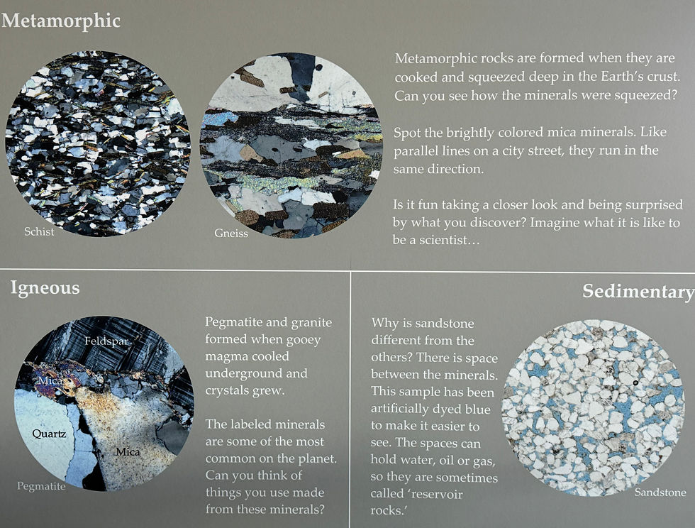
Pink streams of granite spread across the cliffs, coloring and animating the somber Black Canyon. Painted Wall, the two-thousand-foot cliff on the north side of the Black Canyon, was named for the marbling of an intrusive, granite-like rock called pegmatite. In its molten state, this rock squeezed into fractures and joints in the schists and gneisses, creating what are called dikes. As the material slowly cooled, huge interlocking crystals of feldspar, quartz, and mica formed. Because these igneous rocks are more resistant than the schists and gneisses, they weather out as spectacular fins, islands, buttresses, and battlements, relieving the abruptness of the canyon walls.
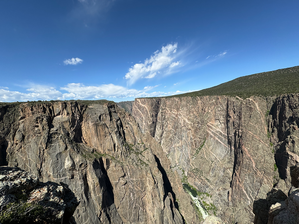
The most widespread rock in Black Canyon is "gneiss", noted for its dark colors and lighter stripes that are often folded into wave-like shapes. It is a metamorphic rock. Schist, similar to gneiss, is another type of metamorphic rock. Its dark color, thin layers, and glittery appearance are easily distinguishable. At 1.8 billion years old, these rocks are some of the oldest on Earth.
My awesome experiences in this National Park will follow in the next blog, as I would like to dedicate this one to the geological history of the park.


Comments